23 Jan, 2019/ by Surveyor Local /News
When you think of drones, you might picture some of the extraordinary displays seen at events such as the Platinum Jubilee with hundreds of the machines with different coloured lights being placed in the night sky to create a pinpoint representation of something, before transforming into something else.
Or maybe you think of how the machines have recently been used in warfare around the world. Or perhaps you've seen the news reports of delivery companies embracing the technology to assist in getting products to their end customers.
But, if you are planning on buying your next property and want to take out a property survey, did you know that chartered surveyors also use drones fitted with cameras as part of the arsenal of tools available to them to assess the structural integrity of the property?
What is a drone?
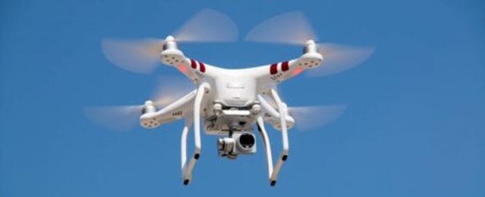
Technically termed an unmanned aerial vehicle (UAV), a drone is best thought of as a robot of sorts that can be flown either by remote control from the ground or via software to control its flight path and destination, as well as managing its purpose when it arrives.
More often than not, a drone has one or more cameras mounted on its body, which films where it is pointed. Sometimes the camera can be manipulated to look in different directions to give a wide sweep, but usually they are static, using the flying instructions to change the direction of the camera.
Because they are regarded as airborne vehicles, the Civil Aviation Authority (CAA) regards the person flying the machine by remote control as the ‘pilot'. As such, the CAA also has strict rules on how drones may be used - this governs safety as the paramount concern and does not look into questions of privacy or nuisance problems created by their use.
While some irresponsible people will use the technology for malicious or illegal purposes, the use of drones is fast becoming another useful tool for many professionals, from film-making to farming. And that includes the chartered surveyor.
How is a drone used in property surveys?
Prior to the use of such technology, if it was safe to do so - safety is always paramount - the surveyor might climb up on a ladder to view the suspect areas of a property, or they might use binoculars having found a suitable vantage point from which to view the property.
But, because it's not always possible to see the close-up detail, surveyors are among those who are turning to drone technology to inspect large or hard-to-access areas of land and property.
All Chartered Surveyors who are members of the Royal Institution of Chartered Surveyors (RICS) conform to all of the guidelines laid down by the CAA and other authorities to guarantee safety at all times. More information on drones and surveying can be found on the RICS website.
If the property they are assessing is not in a congested zone, the pilot can fly the drone so long as the machine is visible at all times. For congested areas, the chartered surveyor as the nominal pilot will be required to lodge plans with the CAA and gain official permission to fly the craft.
The drone will capture a continuous video of its flight or perhaps still photographs of the property's condition, which can be viewed on a device such as a mobile phone, computer or goggles in real time or for later perusal.
After the initial flight to the areas of the building under analysis, there may be certain points of concern for further investigation, allowing the surveyor to hone in on the detail of any particular areas of concern with a further flight. It is a cheap and powerful operation, which is to the benefit of the customer.
Another benefit over standard methods of viewing a property is that drones can be fitted with small spotlights that can be switched on once the drone has reached the desired position, giving a much clearer picture in shadowed spaces (such as the eaves).
So, where that RICS Level 3 Survey might require a detailed inspection of a roof or chimney stack, for example, surveyors are using drones to do that hard work for them.
The drone gives the surveyor the most up-to-date view of its condition, meaning the buyer gets precise information that allows them to decide whether to go ahead with their purchase, pull out or renegotiate the price.
Your surveyor will want to provide you with as complete an assessment of the property you are planning to buy. Like meters that test dampness or other traditional ways of establishing the existence of problems, the use of drone technology is merely an additional tool in the box.
Want to get one of the best local Chartered Surveyors to look over your property and provide you with an expert and detailed survey?
That's why it is really worth contacting Surveyor Local!
Call to get your survey quote started, or to discuss your concerns with the acquisition of your planned property and any issues with the cladding.
